Minnesota wildfire interactive maps show how far infernos have spread
15. May 2025
Three massive, out of control wildfires continue to rage north of Duluth in northeastern Minnesota, as near critical fire weather conditions continue to plague the region, according to the National Weather Service.
Crews are also battling massive wildfires just north of Minnesota in Canada’s Manitoba and Ontario provinces.
As of Thursday morning, the Wildland Fire Application Information Portal reports the fires have spread across more than 37,000 acres:
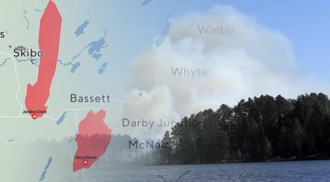
The Eastern Area Complex Incident Team announced on Wednesday that its taken command of both the Jenkins Creek and Camp House fires, managing the two as the “Brimson Complex.”
Below are interactive maps with continuously updated information from the National Interagency Fire Center.
The Jenkins Creek Fire
The Jenkins Creek Fire, which tripled in size between Tuesday night and Wednesday morning, is centered about 60 miles north of Duluth near Hoyt Lakes, just northwest of the Camp House Fire.
The Camp House Road Fire
The Camp House Road Fire was first reported on Sunday afternoon about 45 miles northeast of Duluth. It has since destroyed dozens of structures, cabins and homes, according to the St. Louis County Sheriff’s Office.
The Munger Shaw Fire
First reported on Monday afternoon, the Munger Shaw Fire has spread to 1,300 acres.
How you can help
Donations to support relief for Lake County community members can be made online through the Head of the Lakes United Way.
Donations can also be mailed to Head of the Lakes United Way (please note it’s for wildfire relief): 314 W. Superior St. #750, Duluth, MN 55802.
Donations to support relief for St. Louis County community members can be made online through the United Way Northeastern Minnesota.